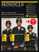
Force for good - Issue 31 - Magazine | Monocle
/

thumbnail text

When disaster strikes, all over the world highly trained emergency relief workers drop their job or their sandwich and fly off to wherever the chaos is.

Within hours, this seasoned network of medics, engineers and technicians sets to work often surrounded by dangers, trauma and complicated politics. However well-oiled the international machinery for deploying, coordinating and delivering aid, it is always a giant challenge just to move about and communicate when a country has been shaken to its core, flooded or ripped to shreds by a hurricane. But some nations are getting it right and new technology is promising faster and more relevant responses.

Over the following pages, our correspondents look at the pioneers search and rescue, and the kit they need.

Method amid the madness

Anastasia Moloney’s letter from Port-au- Prince

Within three days of the earthquake in Haiti, over 60 search and rescue (SAR) teams from all over the world had set up camp around a coordinating tent in Port au Prince. I was working nearby and was impressed by the efficiency with which roughly 2,000 rescue professionals, in their orange or red jump suits and with multiple acronyms, pitched tents each with their national flag, and proceeded to pull out generators, floodlights, satellite internet systems, portable shower kits and heavy lifting and cutting equipment. Not to mention the food and water they remembered for their 160 search dogs.

Some had more kit than others (the UK and Icelandic teams were the most impressively loaded with hardware) and some had bigger, faster teams than others (such as the US squads from New York and Virginia, while the Peru mission only had six members, but they still did their bit). Each country had its ­particular way of working – Nicaragua brought its own military escort. Despite the chaos, the overpowering smell of death and traumatised survivors all around them, most teams, almost all men, set to work with military efficiency (some were elite units of their countries’ armed forces, others were from fire brigades and others were specialised civilian volunteers).

Every morning they turned up at the UN-run coordination tent from where teams would be dispatched. The tent was a frenzy of activity and the sense of urgency to get to the people who were trapped meant there was little time for chatter. Logistics managers coordinated with cartographers who scrambled to produce up-to-date maps pinpointing key buildings and landmarks that had collapsed. SAR teams were assigned a building within a particular sector of Port au Prince, and given a map or GPS coordinates and transport and UN peacekeepers to escort them to each site.

Around town, as they worked their way through the rubble, they left their mark. Using an internationally recognised system, each team would spray symbols on buildings to let other teams know they had been checked. Gradually, more and more walls and rubble were daubed with the time, date and number of people found alive or dead.

SAR teams would often act not on hi-tech data but on tip-offs from locals about trapped people. Their structural engineers determined whether it was safe or not to enter a building. Search dogs often made the job of tracing people quicker. They barked when a person was found alive and started to dig when a person was found dead.

By evening, huddles of weary rescue workers would gather in each others’ campsites discussing their days, abuzz with excitement particularly if children had been pulled alive from the rubble. By 21.00 most teams were tucked into their sleeping bags in preparation for another intense day. Within a fortnight their job was done and their tents folded up. And from then on it was up to the next wave of relief workers to look after the survivors and start helping them to rebuild their lives.

Emergency electronics

Three good ideas that are making it easier for disaster relief teams to do their job

Text message mapping

A simple text messaging service set up two years ago in the midst of Kenya’s post-election violence has turned into a remarkable new tool that is helping aid agencies connect with people during humanitarian crises.

The service, Ushahidi (“testimony” in Swahili), was the brainchild of Kenyan bloggers who wanted to map incidents of violence and peace efforts over the nation. Reports were submitted via SMS and collated on an online map. Messages were then forwarded to the relevant aid agency.

More than 45,000 people used the service during Kenya’s crisis and versions of Ushahidi have since been created for several other humanitarian disasters, including in eastern Congo, South Africa’s xenophobic attacks of 2008, and the recent earthquake in Haiti. Its founders hope to create a web platform that anyone can download to map incidents in their own area.

Network-less mobile phones

Satellite phones are a trusted friend of emergency aid workers, but bandwidth is limited and expensive. So Irish mobile tech firm Altobridge has developed a system that makes it possible to use mobile phones even when local networks are down.

Its portable satellite platform – about the size of a suitcase and set up in under 15 minutes – allows multiple mobile users to tap into networks in other countries.

Altobridge’s director of global defence, Norman Hubbs, points out the advantage over sat-phones: “Instead of one call, it can support seven simultaneously. Two portable systems were sent to Haiti, each which had a capacity to support up to 100 mobile phones, as well as a larger semi-stationary system that could support 5,000.”

A new generation will be introduced later this year that will allow for the transfer of greater amounts of data, beyond text messages and voice.

Real-time satellite imaging

Not so long ago, aid teams had to spend their first days in an emergency zone assessing the damage and reporting back to base so their agency could decide what and who to send, and where. Italy’s Information Technology for Humanitarian Assistance, Cooperation & Action (ITHACA) is speeding up that process with satellite image maps that give aid workers an almost daily update on the situation on the ground even before they reach the site.

Useful for checking road networks and buildings, they also estimate refugee numbers passing through a specific point, says researcher Fabio Giulio Tonolo. In Haiti’s case, raw images were also put on one of Google’s official blogs.

“We’re developing a cost-effective vehicle-mounted camera with GPS,” says Tonolo. “This would allow us to take high-resolution images at ground level over a couple of days. It is difficult to judge the damage to a building from just its roof.”

Who to call?

Nations with the ultimate rescue remedies

Israel:

Israel has more experience than most of bloodshed on the streets. It now trains the western world in emergency response (see page 43). And its international relief unit (page 45) is one of the fastest and best.

Japan:

Around one in five of the world’s earthquakes occur in Japan and its emergency relief teams are known for their experience and technological skill.

Switzerland:

The Swiss have chaired the UN’s International Search & Rescue Advisory Group since helping to found it in 1991. The nation’s mountain rescue expertise gives it a head start and it helps that it has a €211m budget and a 700-strong Swiss Humanitarian Aid Unit.

United States:

The US military’s strength is its “surge” capability. They are often the first on the scene and soldiers aim to be self-sustaining during emergency situations so that they don’t have to rely on NGOs and other relief units.

Share on:

X

Facebook

LinkedIn

LINE

Email

Go back: Contents
Next:

Business

/

sign in to monocle

new to monocle?

Subscriptions start from £120.

Subscribe now

Loading...

/

15

15

Live
Monocle Radio

00:0001:00

  • The Pacific Shift